Monday, June 4, 2007

Day 3


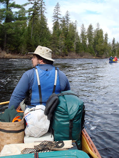
Started the morning with pancakes and headed out. Passed this beautiful brook. Towards Ledge rapids the river widened and the rapids moved towards a sustained class 2. One rip had a funky current and pulled our boat and Rollin and Ed's in, but no problem except for some shipped water.

Finished the day at Burntland Brook Campsite. Did 17 miles by 2:30 pm.

Doucie Brook Pics


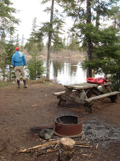
Had a tight tentsite, which was on a frozen area with snow still on the ground. It was also below a raven nest, with a female sitting on eggs. She stopped making noise by dark...

First Camp


Headed past the southeast branch and the river widened. We also passed our first bridge, Saint Juste. One of the other groups on the river with us was at the campsite there, wo we headed to Doucie Brook Campsite. Another group was there, but we were able to squeeze in. It was a 22 mile day. Opened up the first keg and pulled out the black and white cookies to celebrate.

Down the River


First stop was at Turner Bogen for a snack, then Flaws Bogen for lunch.

Water levels


here's a graph showing water flow at nine-mile. We were on the river from May 20-25. The flow levels were excellent for us, although the water levels were falling the whole week.

Sunday, June 3, 2007

We're Off


Getting Going


We loaded up and were ready to start by 10:00 am or so. The angry paddlemen shot is from Phil. The river starts off narrow and fast, with some easy class 1 trips every half mile or so. A fun way to start.

Monday Morning


Breakfast was an inch of wet snow and biscuits and ham.

Baker Lake part 2


So, as the rest of the camp hung out at their campfire in the cold and wet, we had dinner in our wood stove heated tent, real nice...

The Secret Weapon


We call 40 degrees and rain "death weather" up at the Knob in NH. That's the way it was at Baker. Fortunately, we had a secret weapon. Pete and Rollin put it together here.

At Baker Lake


Here's Phil and a guide from another group at the soaking wet Baker North campsite. The site was crowded but adequate.

To Baker Lake


Stopped at the North Maine Woods checkpoint, where we left $486 poorer, in order to pay for day use and camping fees while on the river. Beyond the checkpoint, we traveled the Golden Road and a variety of other gravel ways up to Baker Lake. Road conditions were not good, but passable. As we proceeded, the temperatures continued to drop.

Starting out


The purpose of this blog is to chronicle a trip down Maine's St.John river, which we took May 20-25, 2007.

The St.John is the longest free flowing river east of the Mississippi, and is considered by some to be the "Mt. Everest" of New England wilderness canoe trips.

Six of us met at my friend Pete's home in Milo maine on a chilly and rainy day. We headed to Millinocket and then into the North Maine Woods. We brought three canoes, a restored Old Town OTCA and two North Woods Canoes Atkinson Travelers, which were superb boats for the trip.